Geolocate

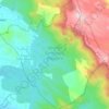
Anad topographic map

Click on the map to display elevation.

About this map

Name: Anad topographic map, elevation, terrain.

Location: Anad, Nedumangad, Thiruvananthapuram, Kerala, 695544, India (8.61307 76.99101 8.65307 77.03101)

Average elevation: 269 ft

Minimum elevation: 154 ft

Maximum elevation: 509 ft

Other topographic maps

Click on a map to view its topography, its elevation and its terrain.
Aryanad

India > Kerala > Nedumangad > Aryanad

Average elevation: 344 ft

Wildlife Sanctuary, Peppara

India > Kerala > Nedumangad

Average elevation: 1,768 ft

Manickal

India > Kerala > Nedumangad > Vettinad

Average elevation: 220 ft

Gear up for your next adventure:

🔦Powerful Headlamps - Ultra-bright hands-free lighting for night navigation
🪶Camp Gear Gift Set - Perfect gift bundle for outdoor fans
🥾Hiking Shoes - Durable and comfortable shoes for trail hiking
🔭Stargazing Telescopes - Perfect for camping in low-light pollution areas shown on maps
👟Men's Trail Runners - Lightweight footwear for fast-paced exploration and light hiking

As an Amazon Associate, this site earns from qualifying purchases at no extra cost to you.