
Thank you for supporting this site ❤️
Make a donation
Make a donation
Gear up for your next adventure:
As an Amazon Associate, this site earns from qualifying purchases at no extra cost to you.
Vishansar topographic map
Click on the map to display elevation.
Thank you for supporting this site ❤️
Make a donation
Make a donation
Gear up for your next adventure:
As an Amazon Associate, this site earns from qualifying purchases at no extra cost to you.
About this map
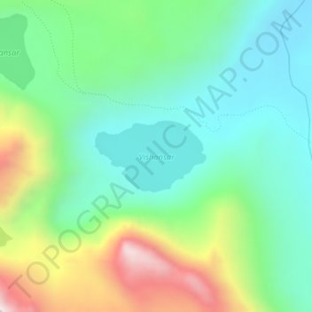
Name: Vishansar topographic map, elevation, terrain.
Location: Vishansar, Gurez, Bandipore District, Jammu and Kashmir, India (34.38438 75.11238 34.39060 75.12406)
Average elevation: 12,657 ft
Minimum elevation: 11,818 ft
Maximum elevation: 14,534 ft
Thank you for supporting this site ❤️
Make a donation
Make a donation
Gear up for your next adventure:
As an Amazon Associate, this site earns from qualifying purchases at no extra cost to you.