Geolocate

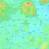
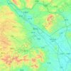
Silong topographic map

Click on the map to display elevation.

About this map

Name: Silong topographic map, elevation, terrain.

Location: Silong, Nanning, Guangxi, China (23.12785 108.60807 23.20785 108.68807)

Average elevation: 1,096 ft

Minimum elevation: 482 ft

Maximum elevation: 2,507 ft

Other topographic maps

Click on a map to view its topography, its elevation and its terrain.

Xixiangtang District

China > Guangxi > Nanning

Average elevation: 427 ft

Heng County

China > Guangxi > Nanning

Average elevation: 443 ft

Qingxiu District

China > Guangxi > Nanning

Average elevation: 459 ft

Xingning District

China > Guangxi > Nanning

Average elevation: 627 ft

Liangqing

China > Guangxi > Nanning

Average elevation: 322 ft

Long'an County

China > Guangxi > Nanning

Average elevation: 837 ft

Yongning District

China > Guangxi > Nanning

Average elevation: 387 ft

Gear up for your next adventure:

🔥Plasma Lighters - Windproof lighters that work in any weather condition
📦Gear Storage Bags - Organize and protect outdoor equipment
🎒Trekking Poles - Sturdy poles for balance and stability on rough terrain
🧭Map Reading Tools - Tools and kits for map navigation
📦Dry Bags Set - Waterproof storage for electronics and clothes

As an Amazon Associate, this site earns from qualifying purchases at no extra cost to you.