
Thank you for supporting this site ❤️
Make a donation
Make a donation
Gear up for your next adventure:
As an Amazon Associate, this site earns from qualifying purchases at no extra cost to you.
Hüttendorf topographic map
Click on the map to display elevation.
Thank you for supporting this site ❤️
Make a donation
Make a donation
Gear up for your next adventure:
As an Amazon Associate, this site earns from qualifying purchases at no extra cost to you.
About this map
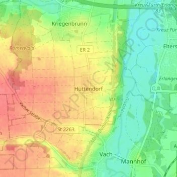
Name: Hüttendorf topographic map, elevation, terrain.
Location: Hüttendorf, Erlangen, Bayern, 91058, Deutschland (49.52166 10.94092 49.56166 10.98092)
Average elevation: 994 ft
Minimum elevation: 892 ft
Maximum elevation: 1,102 ft
Thank you for supporting this site ❤️
Make a donation
Make a donation
Gear up for your next adventure:
As an Amazon Associate, this site earns from qualifying purchases at no extra cost to you.