
Thank you for supporting this site ❤️
Make a donation
Make a donation
Gear up for your next adventure:
As an Amazon Associate, this site earns from qualifying purchases at no extra cost to you.
Peapully topographic map
Click on the map to display elevation.
Thank you for supporting this site ❤️
Make a donation
Make a donation
Gear up for your next adventure:
As an Amazon Associate, this site earns from qualifying purchases at no extra cost to you.
About this map
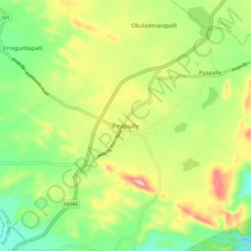
Name: Peapully topographic map, elevation, terrain.
Location: Peapully, Peapally, Nandyal District, Andhra Pradesh, India (15.19495 77.69908 15.27495 77.77908)
Average elevation: 1,663 ft
Minimum elevation: 1,325 ft
Maximum elevation: 2,152 ft
Thank you for supporting this site ❤️
Make a donation
Make a donation
Gear up for your next adventure:
As an Amazon Associate, this site earns from qualifying purchases at no extra cost to you.