Geolocate

Garoua topographic map

Click on the map to display elevation.

About this map
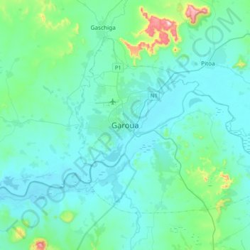
Name: Garoua topographic map, elevation, terrain.

Location: Garoua, Garoua I, Communauté urbaine de Garoua, Bénoué, North, Cameroon (9.14707 13.23345 9.46707 13.55345)

Average elevation: 771 ft

Minimum elevation: 561 ft

Maximum elevation: 2,349 ft

Other topographic maps

Click on a map to view its topography, its elevation and its terrain.

Lagdo

Cameroon > North > Bénoué

Average elevation: 1,017 ft

Ngong

Cameroon > North > Bénoué

Average elevation: 883 ft

Pitoa

Cameroon > North > Bénoué

Average elevation: 951 ft

Gear up for your next adventure:

🦟Ultrasonic Repellers - Create a bug-free zone at your camp or rest stop
🖼️Topo Map Wall Art - Decorative topographic prints of famous peaks and regions
👟Trail Running Shoes - Lightweight shoes for trail runners
🚁Photography Drones - Capture stunning aerial views of landforms and topography
📱Solar Portable Charger - Solar power bank for charging devices off‑grid

As an Amazon Associate, this site earns from qualifying purchases at no extra cost to you.