
Thank you for supporting this site ❤️
Make a donation
Make a donation
Gear up for your next adventure:
As an Amazon Associate, this site earns from qualifying purchases at no extra cost to you.
Llambilles topographic map
Click on the map to display elevation.
Thank you for supporting this site ❤️
Make a donation
Make a donation
Gear up for your next adventure:
As an Amazon Associate, this site earns from qualifying purchases at no extra cost to you.
About this map
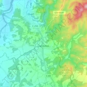
Name: Llambilles topographic map, elevation, terrain.
Location: Llambilles, Gironès, Gerona, Catalonië, 17243, Spanje (41.90697 2.83468 41.93902 2.90218)
Average elevation: 459 ft
Minimum elevation: 256 ft
Maximum elevation: 1,037 ft
Thank you for supporting this site ❤️
Make a donation
Make a donation
Gear up for your next adventure:
As an Amazon Associate, this site earns from qualifying purchases at no extra cost to you.