Geolocate

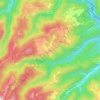
Gregurić Breg topographic map

Click on the map to display elevation.

About this map

Name: Gregurić Breg topographic map, elevation, terrain.

Location: Gregurić Breg, Grad Samobor, Zagreb County, Croatia (45.76957 15.64309 45.80087 15.67616)

Average elevation: 1,247 ft

Minimum elevation: 614 ft

Maximum elevation: 1,936 ft

Other topographic maps

Click on a map to view its topography, its elevation and its terrain.
Beder

Croatia > Zagreb County > Grad Samobor

Average elevation: 1,358 ft

Gear up for your next adventure:

🧢Outdoor Hiking Hat - Sun protection hat for outdoor explorers
🏔️Mountain Trail Maps - High‑detail maps for popular peaks
🔦Powerful Headlamps - Ultra-bright hands-free lighting for night navigation
🥾Women's Hiking Boots - Top-rated trail boots with ankle support and superior grip
🥇GPS Hiking Watch - Multi‑sport GPS watch with navigation and trail tracking

As an Amazon Associate, this site earns from qualifying purchases at no extra cost to you.