
钤山镇 topographic map
Interactive map
Click on the map to display elevation.
About this map
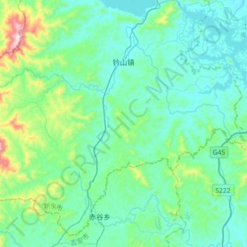
Name: 钤山镇 topographic map, elevation, terrain.
Location: 钤山镇, 分宜县, 新余市, 江西省, 中国 (27.53487 114.52302 27.73829 114.77874)
Average elevation: 607 ft
Minimum elevation: 177 ft
Maximum elevation: 2,828 ft
Other topographic maps
Click on a map to view its topography, its elevation and its terrain.