
Shindagin Hollow State Forest topographic map
Interactive map
Click on the map to display elevation.
About this map
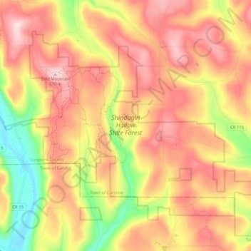
Name: Shindagin Hollow State Forest topographic map, elevation, terrain.
Average elevation: 1,499 ft
Minimum elevation: 938 ft
Maximum elevation: 1,893 ft
Tompkins County trails, hiking, mountain biking, running and outdoor activities
Other topographic maps
Click on a map to view its topography, its elevation and its terrain.
Caroline Depot
United States > New York > Tompkins County > Town of Caroline
Average elevation: 1,207 ft