
Thank you for supporting this site ❤️
Make a donation
Make a donation
Gear up for your next adventure:
As an Amazon Associate, this site earns from qualifying purchases at no extra cost to you.
Wadarwadi topographic map
Click on the map to display elevation.
Thank you for supporting this site ❤️
Make a donation
Make a donation
Gear up for your next adventure:
As an Amazon Associate, this site earns from qualifying purchases at no extra cost to you.
About this map
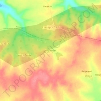
Name: Wadarwadi topographic map, elevation, terrain.
Location: Wadarwadi, Ahmadpur, Latur District, Maharashtra, India (18.80549 76.94725 18.84549 76.98725)
Average elevation: 1,604 ft
Minimum elevation: 1,430 ft
Maximum elevation: 1,699 ft
Thank you for supporting this site ❤️
Make a donation
Make a donation
Gear up for your next adventure:
As an Amazon Associate, this site earns from qualifying purchases at no extra cost to you.