Geolocate

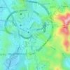
Al Hazm topographic map

Click on the map to display elevation.

About this map

Name: Al Hazm topographic map, elevation, terrain.

Location: Al Hazm, Makkah Al Mukarramah, Makkah Region, Saudi Arabia (21.64080 40.09989 21.68080 40.13989)

Average elevation: 2,169 ft

Minimum elevation: 1,768 ft

Maximum elevation: 3,599 ft

Other topographic maps

Click on a map to view its topography, its elevation and its terrain.

At Tanim

Saudi Arabia > Makkah Region > Makkah Al Mukarramah

Average elevation: 1,115 ft

Ajyad

Saudi Arabia > Makkah Region > Makkah Al Mukarramah

Average elevation: 1,194 ft

Gear up for your next adventure:

🧣Hiking Neck Gaiter - Multi‑use neck protection for outdoor weather
📦Dry Bags Set - Waterproof storage for electronics and clothes
🔥Camping Stove - Portable stove for camping and backcountry cooking
🛌Ultralight Sleeping Bags - Compact down bags for cold nights in the wilderness
⛺Backpacking Tents - Weight-optimized shelters for multi-day topographic surveys

As an Amazon Associate, this site earns from qualifying purchases at no extra cost to you.