
Chechnya topographic map
Interactive map
Click on the map to display elevation.
About this map
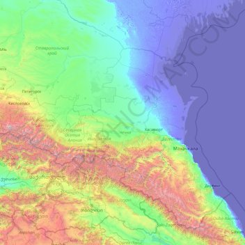
Name: Chechnya topographic map, elevation, terrain.
Location: Chechnya, North Caucasus federal district, Russia (40.83761 43.13850 45.95761 48.25850)
Average elevation: 2,110 ft
Minimum elevation: -105 ft
Maximum elevation: 17,484 ft
Other topographic maps
Click on a map to view its topography, its elevation and its terrain.