
Thank you for supporting this site ❤️
Make a donation
Make a donation
Gear up for your next adventure:
As an Amazon Associate, this site earns from qualifying purchases at no extra cost to you.
Portovelo topographic map
Click on the map to display elevation.
Thank you for supporting this site ❤️
Make a donation
Make a donation
Gear up for your next adventure:
As an Amazon Associate, this site earns from qualifying purchases at no extra cost to you.
About this map
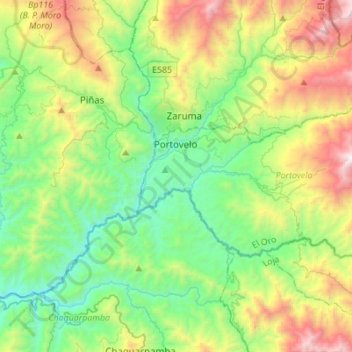
Name: Portovelo topographic map, elevation, terrain.
Location: Portovelo, El Oro, 071153, Ecuador (-3.81328 -79.64745 -3.66696 -79.37265)
Average elevation: 3,812 ft
Minimum elevation: 1,493 ft
Maximum elevation: 8,878 ft
Thank you for supporting this site ❤️
Make a donation
Make a donation
Gear up for your next adventure:
As an Amazon Associate, this site earns from qualifying purchases at no extra cost to you.