Geolocate

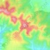
Altıntepe topographic map

Click on the map to display elevation.

About this map

Name: Altıntepe topographic map, elevation, terrain.

Location: Altıntepe, Haliliye, Şanlıurfa, Southeastern Anatolia Region, 63050, Turkey (37.10081 38.88419 37.14081 38.92419)

Average elevation: 1,467 ft

Minimum elevation: 1,404 ft

Maximum elevation: 1,542 ft

Other topographic maps

Click on a map to view its topography, its elevation and its terrain.

Oğulbey Mahallesi

Turkey > Haliliye

Average elevation: 1,555 ft

Göbekli Tepe

Turkey > Haliliye > Örencik Mahallesi

Average elevation: 2,303 ft

Göbekli Tepe

Turkey > Haliliye > Örencik Mahallesi

Average elevation: 2,303 ft

Anaz Mahallesi

Turkey > Haliliye

Average elevation: 1,522 ft

Göbekli Tepe

Turkey > Haliliye > Örencik Mahallesi

Average elevation: 2,303 ft

Örencik Mahallesi

Turkey > Haliliye

Average elevation: 2,182 ft

Gear up for your next adventure:

🔋Rechargeable Batteries - Power up your outdoor devices
📚Navigation Handbooks - Master the art of reading topographic maps and using a compass
🕶️Glacier Sunglasses - Side shields to protect eyes from high-altitude snow glare
🔋Solar Power Banks - Keep your GPS and phone charged in remote wilderness areas
🪶Compact Camp Shovel - Folding shovel for campsite tasks

As an Amazon Associate, this site earns from qualifying purchases at no extra cost to you.