Geolocate

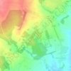
Sleedagh topographic map

Click on the map to display elevation.

About this map

Name: Sleedagh topographic map, elevation, terrain.

Location: Sleedagh, Newcastle ED, The Borough District of Wexford, County Wexford, Leinster, Ireland (52.26089 -6.54927 52.27696 -6.53351)

Average elevation: 138 ft

Minimum elevation: 66 ft

Maximum elevation: 236 ft

Other topographic maps

Click on a map to view its topography, its elevation and its terrain.
Gear up for your next adventure:

🔌Solar Panel Charger - Charge gear sustainably outdoors
🧯Portable Fire Pit - Compact fire pit for camping spots
🛠️Backpacking Tool Kit - Essential toolkit for outdoor repairs
🔥Fast-Boil Camping Stoves - Efficient cooking systems for quick trail meals
🚪Portable Camp Chair - Foldable chair for comfort at camp

As an Amazon Associate, this site earns from qualifying purchases at no extra cost to you.