Chapicuy topographic map
Interactive map
Click on the map to display elevation.
About this map
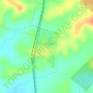
Name: Chapicuy topographic map, elevation, terrain.
Location: Chapicuy, Paysandú, 60005, Uruguay (-31.66674 -57.89219 -31.65606 -57.88449)
Average elevation: 138 ft
Minimum elevation: 79 ft
Maximum elevation: 236 ft
Other topographic maps
Click on a map to view its topography, its elevation and its terrain.
Bella Vista
Uruguay > Paysandú > Bella Vista
Bella Vista, Paysandú, 50000, Uruguay
Average elevation: 285 ft
Federación
Uruguay > Paysandú > Federación
Federación, Paysandú, 60000, Uruguay
Average elevation: 279 ft
Nuevo Paysandú
Uruguay > Paysandú > Nuevo Paysandú
Nuevo Paysandú, Paysandú, 60000, Uruguay
Average elevation: 46 ft
Cerro Chato
Uruguay > Paysandú > Cerro Chato
Cerro Chato, Paysandú, 60001, Uruguay
Average elevation: 315 ft