Geolocate

Baltar topographic map

Click on the map to display elevation.

About this map
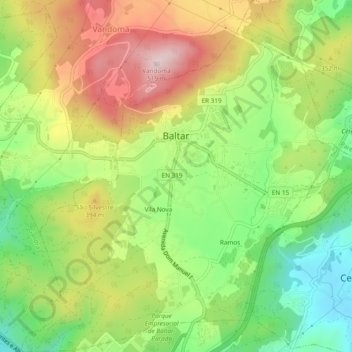
Name: Baltar topographic map, elevation, terrain.

Location: Baltar, Paredes, Porto, Portugal (41.17072 -8.40958 41.20652 -8.36656)

Average elevation: 1,014 ft

Minimum elevation: 456 ft

Maximum elevation: 1,686 ft

Other topographic maps

Click on a map to view its topography, its elevation and its terrain.
Estação

Portugal > Porto > Paredes > Sobreira

Average elevation: 486 ft

Gear up for your next adventure:

📡Handheld GPS Device - Reliable handheld GPS for outdoor navigation
🦶Carbon Trekking Poles - Reduce knee impact on steep descents with ultra-light poles
🧭Hiking Compass - Precision compass for reliable navigation in the wilderness
🧣Merino Neck Gaiters - Multi-functional headwear for wind and sun protection
🩹Survival Bandages - High‑quality bandages for emergencies

As an Amazon Associate, this site earns from qualifying purchases at no extra cost to you.