Geolocate

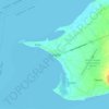
Looc topographic map

Click on the map to display elevation.

About this map

Name: Looc topographic map, elevation, terrain.

Location: Looc, Panglao, Bohol, Central Visayas, 6340, Philippines (9.58179 123.74038 9.59600 123.76799)

Average elevation: 20 ft

Minimum elevation: 0 ft

Maximum elevation: 39 ft

Other topographic maps

Click on a map to view its topography, its elevation and its terrain.
Panglao

Philippines > Bohol > Panglao

Average elevation: 13 ft

Daorong

Philippines > Bohol > Panglao > Danao

Average elevation: 10 ft

Canghilbas

Philippines > Bohol > Panglao > Lourdes

Average elevation: 72 ft

Gear up for your next adventure:

🧯Portable Fire Pit - Compact fire pit for camping spots
🎁Geography Themed Gifts - Unique gift ideas for map lovers and geography enthusiasts
🧤Tactile Hiking Gloves - Keep hands warm while operating GPS and smartphone screens
⛑️Personal Locator Beacon - Safety beacon for emergencies
📱Solar Portable Charger - Solar power bank for charging devices off‑grid

As an Amazon Associate, this site earns from qualifying purchases at no extra cost to you.