
Thank you for supporting this site ❤️
Make a donation
Make a donation
Gear up for your next adventure:
As an Amazon Associate, this site earns from qualifying purchases at no extra cost to you.
Palombara topographic map
Click on the map to display elevation.
Thank you for supporting this site ❤️
Make a donation
Make a donation
Gear up for your next adventure:
As an Amazon Associate, this site earns from qualifying purchases at no extra cost to you.
About this map
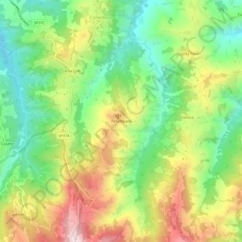
Name: Palombara topographic map, elevation, terrain.
Location: Palombara, Castelli, Teramo, Abruzzo, 64041, Italia (42.47778 13.71538 42.51778 13.75538)
Average elevation: 1,736 ft
Minimum elevation: 1,099 ft
Maximum elevation: 2,608 ft
Thank you for supporting this site ❤️
Make a donation
Make a donation
Gear up for your next adventure:
As an Amazon Associate, this site earns from qualifying purchases at no extra cost to you.