Geolocate

Sumidero topographic map

Click on the map to display elevation.

About this map

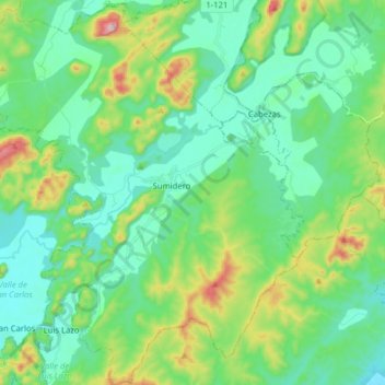
Name: Sumidero topographic map, elevation, terrain.

Location: Sumidero, Minas de Matahambre, Pinar del Rio, Cuba (22.37123 -83.99785 22.51719 -83.84851)

Average elevation: 581 ft

Minimum elevation: 200 ft

Maximum elevation: 1,739 ft

Gear up for your next adventure:

🧢Sun Protection Hats - Wide-brimmed and UPF-rated hats for high-altitude sun safety
🧭GPS Watch Accessories - Bands and chargers for GPS watches
🍳Camping Cook Set - Complete cookware for outdoor meals
🧤Hiking Gloves - Protective gloves for rugged trails
🕶️Glacier Sunglasses - Side shields to protect eyes from high-altitude snow glare

As an Amazon Associate, this site earns from qualifying purchases at no extra cost to you.