
Thank you for supporting this site ❤️
Make a donation
Make a donation
Gear up for your next adventure:
As an Amazon Associate, this site earns from qualifying purchases at no extra cost to you.
多玛乡 topographic map
Click on the map to display elevation.
Thank you for supporting this site ❤️
Make a donation
Make a donation
Gear up for your next adventure:
As an Amazon Associate, this site earns from qualifying purchases at no extra cost to you.
About this map
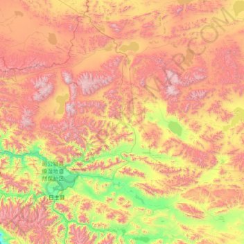
Name: 多玛乡 topographic map, elevation, terrain.
Location: 多玛乡, 日土县, མངའ་རིས་ས་ཁུལ་ 阿里地区, Tibet, China (33.50877 78.65275 34.48625 81.06846)
Average elevation: 16,821 ft
Minimum elevation: 13,632 ft
Maximum elevation: 21,982 ft
Thank you for supporting this site ❤️
Make a donation
Make a donation
Gear up for your next adventure:
As an Amazon Associate, this site earns from qualifying purchases at no extra cost to you.