
Thank you for supporting this site ❤️
Make a donation
Make a donation
Gear up for your next adventure:
As an Amazon Associate, this site earns from qualifying purchases at no extra cost to you.
Iguala topographic map
Click on the map to display elevation.
Thank you for supporting this site ❤️
Make a donation
Make a donation
Gear up for your next adventure:
As an Amazon Associate, this site earns from qualifying purchases at no extra cost to you.
About this map
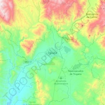
Name: Iguala topographic map, elevation, terrain.
Location: Iguala, Iguala de la Independencia, Guerrero, 40080, Mexico (18.18664 -99.69769 18.50664 -99.37769)
Average elevation: 3,642 ft
Minimum elevation: 1,893 ft
Maximum elevation: 7,890 ft
Thank you for supporting this site ❤️
Make a donation
Make a donation
Gear up for your next adventure:
As an Amazon Associate, this site earns from qualifying purchases at no extra cost to you.