Geolocate

Hemsby topographic map

Click on the map to display elevation.

About this map
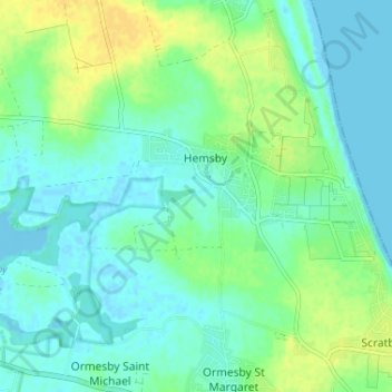
Name: Hemsby topographic map, elevation, terrain.

Location: Hemsby, Great Yarmouth, Norfolk, England, United Kingdom (52.68399 1.65025 52.70393 1.71506)

Average elevation: 26 ft

Minimum elevation: -13 ft

Maximum elevation: 75 ft

Gear up for your next adventure:

🪄Magnetic Compass - Accurate compass for navigation
⌚GPS Sports Watch - GPS watch for running, hiking and training
🦶Carbon Trekking Poles - Reduce knee impact on steep descents with ultra-light poles
🪶Multi‑Purpose Knife - Useful blade for camp and trail
🧯Portable Fire Pit - Compact fire pit for camping spots

As an Amazon Associate, this site earns from qualifying purchases at no extra cost to you.