Geolocate

Moseley topographic map

Click on the map to display elevation.

About this map

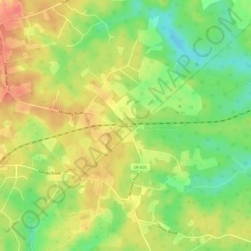
Name: Moseley topographic map, elevation, terrain.

Location: Moseley, Powhatan County, Virginia, United States (37.45489 -77.79879 37.49489 -77.75879)

Average elevation: 312 ft

Minimum elevation: 210 ft

Maximum elevation: 397 ft

Powhatan County trails, hiking, mountain biking, running and outdoor activities

Gear up for your next adventure:

🎒Day Hiking Backpack - Lightweight backpack perfect for day trips and outdoor adventures
📚Navigation Handbooks - Master the art of reading topographic maps and using a compass
🪶Multi‑Purpose Knife - Useful blade for camp and trail
🎒Trail Energy Bars - High‑calorie bars for hiking energy
🕶️GPS Smartphone Mount - Secure mount for phone navigation

As an Amazon Associate, this site earns from qualifying purchases at no extra cost to you.