
Thank you for supporting this site ❤️
Make a donation
Make a donation
Gear up for your next adventure:
As an Amazon Associate, this site earns from qualifying purchases at no extra cost to you.
Ocotito topographic map
Click on the map to display elevation.
Thank you for supporting this site ❤️
Make a donation
Make a donation
Gear up for your next adventure:
As an Amazon Associate, this site earns from qualifying purchases at no extra cost to you.
About this map
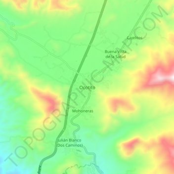
Name: Ocotito topographic map, elevation, terrain.
Location: Ocotito, Chilpancingo de los Bravo, Guerrero, México (17.20528 -99.55472 17.28528 -99.47472)
Average elevation: 2,530 ft
Minimum elevation: 1,335 ft
Maximum elevation: 4,669 ft
Thank you for supporting this site ❤️
Make a donation
Make a donation
Gear up for your next adventure:
As an Amazon Associate, this site earns from qualifying purchases at no extra cost to you.