Geolocate

Edwardsville topographic map

Click on the map to display elevation.

About this map

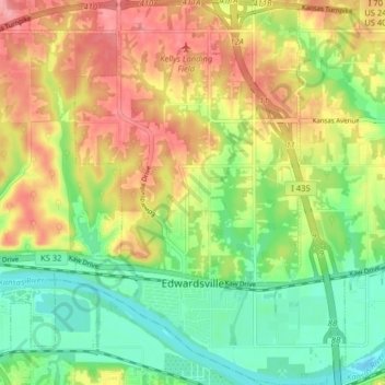
Name: Edwardsville topographic map, elevation, terrain.

Location: Edwardsville, Wyandotte County, Kansas, 66113, United States (39.04466 -94.85362 39.10668 -94.78793)

Average elevation: 869 ft

Minimum elevation: 719 ft

Maximum elevation: 1,047 ft

Wyandotte County trails, hiking, mountain biking, running and outdoor activities

Gear up for your next adventure:

❄️Traction Cleats - Prevent slips on icy trails during winter hikes
🗺️Topographic Maps - Detailed topo maps for hiking, exploring and outdoor navigation
🧯Portable Fire Pit - Compact fire pit for camping spots
🧤Tactile Hiking Gloves - Keep hands warm while operating GPS and smartphone screens
🪶LED Camping Lantern - Bright lantern for camp lighting

As an Amazon Associate, this site earns from qualifying purchases at no extra cost to you.