
曲山镇 topographic map
Interactive map
Click on the map to display elevation.
About this map
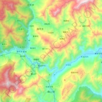
Name: 曲山镇 topographic map, elevation, terrain.
Location: 曲山镇, 北川羌族自治县, 绵阳市, 四川省, 中国 (31.79432 104.38619 31.94785 104.57311)
Average elevation: 4,154 ft
Minimum elevation: 1,965 ft
Maximum elevation: 7,635 ft
Other topographic maps
Click on a map to view its topography, its elevation and its terrain.