
Make a donation
Gear up for your next adventure:
As an Amazon Associate, this site earns from qualifying purchases at no extra cost to you.
Monrovia topographic map
Click on the map to display elevation.
Make a donation
Gear up for your next adventure:
As an Amazon Associate, this site earns from qualifying purchases at no extra cost to you.
About this map
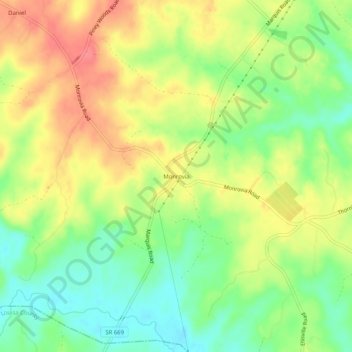
Name: Monrovia topographic map, elevation, terrain.
Location: Monrovia, Orange County, Virginia, United States (38.13514 -78.01889 38.17514 -77.97889)
Average elevation: 358 ft
Minimum elevation: 249 ft
Maximum elevation: 469 ft
Orange County trails, hiking, mountain biking, running and outdoor activities
Make a donation
Gear up for your next adventure:
As an Amazon Associate, this site earns from qualifying purchases at no extra cost to you.
Other topographic maps
Click on a map to view its topography, its elevation and its terrain.
Barboursville Community Park
United States > Virginia > Orange County > Barboursville
Average elevation: 518 ft