
Make a donation
Gear up for your next adventure:
As an Amazon Associate, this site earns from qualifying purchases at no extra cost to you.
Bukit Monges topographic map
Click on the map to display elevation.
Make a donation
Gear up for your next adventure:
As an Amazon Associate, this site earns from qualifying purchases at no extra cost to you.
About this map
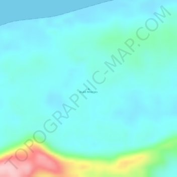
Name: Bukit Monges topographic map, elevation, terrain.
Average elevation: 121 ft
Minimum elevation: 0 ft
Maximum elevation: 627 ft
Make a donation
Gear up for your next adventure:
As an Amazon Associate, this site earns from qualifying purchases at no extra cost to you.
Other topographic maps
Click on a map to view its topography, its elevation and its terrain.
Pulau Waigeo
Indonesia > Southwest Papua > Raja Ampat
The area of the island is 3,155 square kilometres (1,218 square miles); the highest elevations are 958-metre-high (3,143-foot) Buffalo Horn (Gunung Nok) and 939-metre-high (3,081-foot) Serodjil. From west to east, the island measures approximately 110 km (68 mi), north–south about 50 kilometres (31 miles).
Average elevation: 121 ft