
Make a donation
Gear up for your next adventure:
As an Amazon Associate, this site earns from qualifying purchases at no extra cost to you.
Elisenhof topographic map
Click on the map to display elevation.
Make a donation
Gear up for your next adventure:
As an Amazon Associate, this site earns from qualifying purchases at no extra cost to you.
Elisenhof
Ortschaften: Bałdy (Balden) | Biedówko (Ernestinenhöhe) | Bruchwałd (Bruchwalde) | Dzierzgunka (Dziergunken/Kiebitzbruch) | Dziuchy (Dzuchen/Grabenau Wald) | Gąsiorowo (Gonschorowen/Lichtenstein) | Giławki (Klein Gillau) | Groszkowo (Graskau) | Groszkowo (Osada) | Kaletka (Kaletka, Forst) | Kołpaki (Kolpacken/Kleinpuppen) | Kopanki (Kopanken) | Kośno (Koschno) | Łajs (Layß) | Lalka (Lallka/Kleinramuck) | Linowo (Leynau/Leinau) | Linowo (Osada) | Mędrzyny (Mendrienen) | Nerwik (Nerwigk) | Nowe Pajtuny (Neu Pathaunen) | Nowy Przykop (Neu Przykopp/Neu Grabenau) | Nowy Ramuk (Neu Ramuck) | Pajtuński Młyn (Pathaunenmühle) | Podlazy (Podlassen/Klausenhof) | Pokrzywy (Friedrichstädt) | Prejłowo (Osada) | Przykopiec (Przykopp Forst/Wilhelmshütte) | Purda Leśna (Purden, Forst) | Rykowiec (Rykowitz/Rickenhof) | Silice (Quidlitz) | Stara Kaletka (Alt Kaletka/Teerwalde) | Wesołowo (Wessolowen/Frohwalde) | Wojtkowizna (Karlberg) | Wygoda (Wygodda/Waldruh) | Wyrandy (Wyranden/Wiranden) | Zaborowo (Saborowen/Heideberg) | Zapurdka (Purden, Mühle)
Make a donation
Gear up for your next adventure:
As an Amazon Associate, this site earns from qualifying purchases at no extra cost to you.
About this map
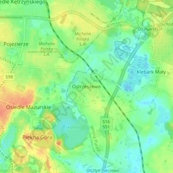
Name: Elisenhof topographic map, elevation, terrain.
Average elevation: 427 ft
Minimum elevation: 374 ft
Maximum elevation: 505 ft
Make a donation
Gear up for your next adventure:
As an Amazon Associate, this site earns from qualifying purchases at no extra cost to you.
Other topographic maps
Click on a map to view its topography, its elevation and its terrain.
Bischofsburg
Polen > Woiwodschaft Ermland-Masuren > powiat olsztyński
Die Stadt liegt im historischen Ermland, im östlichen Bereich der Allensteiner Seenplatte (poln. Pojezierze Olsztyńskie), die zum masurischen Seengebiet gehört. Auf Gemeindegebiet liegt der Daddaisee (poln. Dadaj), er ist mit 10 km² der größte See der Seenplatte. Dort mündet das kleine Flüsschen Dimmer…
Average elevation: 505 ft
Seeburg
Polen > Woiwodschaft Ermland-Masuren > powiat olsztyński
Nachdem die ermländischen Bischöfe in der zweiten Hälfte des 13. Jahrhunderts begonnen hatten, den als Wildnis beschriebenen Südosten des Bistums zu besiedeln, errichteten sie unter anderem auf einer kleinen Anhöhe am Ufer des Simserflusses eine Burg zum Schutz und als Zufluchtsstätte für die dort…
Average elevation: 466 ft