
Thank you for supporting this site ❤️
Make a donation
Make a donation
Gear up for your next adventure:
As an Amazon Associate, this site earns from qualifying purchases at no extra cost to you.
Rosemère topographic map
Click on the map to display elevation.
Thank you for supporting this site ❤️
Make a donation
Make a donation
Gear up for your next adventure:
As an Amazon Associate, this site earns from qualifying purchases at no extra cost to you.
About this map
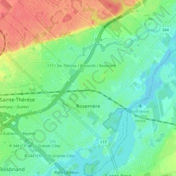
Name: Rosemère topographic map, elevation, terrain.
Location: Rosemère, Thérèse-De Blainville, Laurentides, Quebec, Canada (45.61092 -73.82855 45.66467 -73.76793)
Average elevation: 121 ft
Minimum elevation: 56 ft
Maximum elevation: 246 ft
Thank you for supporting this site ❤️
Make a donation
Make a donation
Gear up for your next adventure:
As an Amazon Associate, this site earns from qualifying purchases at no extra cost to you.