
Thank you for supporting this site ❤️
Make a donation
Make a donation
Gear up for your next adventure:
As an Amazon Associate, this site earns from qualifying purchases at no extra cost to you.
Dagnente topographic map
Click on the map to display elevation.
Thank you for supporting this site ❤️
Make a donation
Make a donation
Gear up for your next adventure:
As an Amazon Associate, this site earns from qualifying purchases at no extra cost to you.
About this map
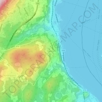
Name: Dagnente topographic map, elevation, terrain.
Location: Dagnente, Campagna, Arona, Novara, Piemonte, 28046, Italia (45.76121 8.51502 45.80121 8.55502)
Average elevation: 1,001 ft
Minimum elevation: 623 ft
Maximum elevation: 2,100 ft
Thank you for supporting this site ❤️
Make a donation
Make a donation
Gear up for your next adventure:
As an Amazon Associate, this site earns from qualifying purchases at no extra cost to you.