
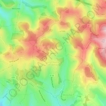
Savaton topographic map
Interactive map
Click on the map to display elevation.
About this map
Name: Savaton topographic map, elevation, terrain.
Average elevation: 2,211 ft
Minimum elevation: 1,736 ft
Maximum elevation: 2,700 ft
Other topographic maps
Click on a map to view its topography, its elevation and its terrain.
Sainte-Agathe-en-Donzy
France > Auvergne-Rhône-Alpes > Loire > Sainte-Agathe-en-Donzy
Average elevation: 2,201 ft