
Thank you for supporting this site ❤️
Make a donation
Make a donation
Gear up for your next adventure:
As an Amazon Associate, this site earns from qualifying purchases at no extra cost to you.
Michaelston-y-Vedw topographic map
Click on the map to display elevation.
Thank you for supporting this site ❤️
Make a donation
Make a donation
Gear up for your next adventure:
As an Amazon Associate, this site earns from qualifying purchases at no extra cost to you.
About this map
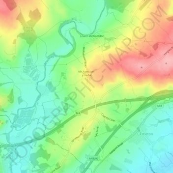
Name: Michaelston-y-Vedw topographic map, elevation, terrain.
Location: Michaelston-y-Vedw, Newport, Wales, United Kingdom (51.53694 -3.11890 51.56860 -3.06510)
Average elevation: 177 ft
Minimum elevation: 16 ft
Maximum elevation: 413 ft
Thank you for supporting this site ❤️
Make a donation
Make a donation
Gear up for your next adventure:
As an Amazon Associate, this site earns from qualifying purchases at no extra cost to you.