Geolocate

Gitega topographic map

Click on the map to display elevation.

About this map

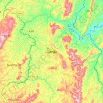
Name: Gitega topographic map, elevation, terrain.

Location: Gitega, Burundi (-3.58850 29.76497 -3.26850 30.08497)

Average elevation: 5,400 ft

Minimum elevation: 4,531 ft

Maximum elevation: 6,752 ft

Gear up for your next adventure:

🧭Compass with Lanyard - Easy‑carry compass for navigation
🪑Portable Camp Table - Compact table for campsite meals
🪶Trail Camera - Capture wildlife on your hikes
💧Water Filtration Bottles - Safely drink from streams and lakes while exploring
🕶️Glacier Sunglasses - Side shields to protect eyes from high-altitude snow glare

As an Amazon Associate, this site earns from qualifying purchases at no extra cost to you.