Geolocate

Ravan topographic map

Click on the map to display elevation.

About this map

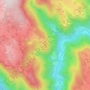
Name: Ravan topographic map, elevation, terrain.

Location: Ravan, Tolmin, Slovenia (46.11212 13.89370 46.11222 13.89380)

Average elevation: 1,634 ft

Minimum elevation: 650 ft

Maximum elevation: 2,444 ft

Gear up for your next adventure:

🔭Stargazing Telescopes - Perfect for camping in low-light pollution areas shown on maps
🦟Ultrasonic Repellers - Create a bug-free zone at your camp or rest stop
🌄Hiking Binoculars - Compact binoculars for scenic views and trail spotting
🥩Freeze-Dried Meals - Nutritious and lightweight food for remote expeditions
📶Vehicle Signal Boosters - Improve reception in rural areas while driving to trailheads

As an Amazon Associate, this site earns from qualifying purchases at no extra cost to you.