
Thank you for supporting this site ❤️
Make a donation
Make a donation
Gear up for your next adventure:
As an Amazon Associate, this site earns from qualifying purchases at no extra cost to you.
Armental topographic map
Click on the map to display elevation.
Thank you for supporting this site ❤️
Make a donation
Make a donation
Gear up for your next adventure:
As an Amazon Associate, this site earns from qualifying purchases at no extra cost to you.
About this map
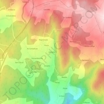
Name: Armental topographic map, elevation, terrain.
Location: Armental, A Peroxa, Ourense, Galicia, 27528, España (42.45341 -7.85225 42.49341 -7.81225)
Average elevation: 1,883 ft
Minimum elevation: 1,191 ft
Maximum elevation: 2,392 ft
Thank you for supporting this site ❤️
Make a donation
Make a donation
Gear up for your next adventure:
As an Amazon Associate, this site earns from qualifying purchases at no extra cost to you.