
Make a donation
Gear up for your next adventure:
As an Amazon Associate, this site earns from qualifying purchases at no extra cost to you.
White Hall Estates topographic map
Click on the map to display elevation.
Make a donation
Gear up for your next adventure:
As an Amazon Associate, this site earns from qualifying purchases at no extra cost to you.
About this map
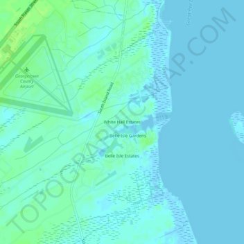
Name: White Hall Estates topographic map, elevation, terrain.
Average elevation: 10 ft
Minimum elevation: -16 ft
Maximum elevation: 36 ft
Georgetown County trails, hiking, mountain biking, running and outdoor activities
Make a donation
Gear up for your next adventure:
As an Amazon Associate, this site earns from qualifying purchases at no extra cost to you.
Other topographic maps
Click on a map to view its topography, its elevation and its terrain.
Huntington Beach State Park
United States > South Carolina > Georgetown County > Murrells Inlet
Average elevation: 7 ft
Brookgreen Gardens
United States > South Carolina > Georgetown County > Murrells Inlet
Average elevation: 13 ft