Geolocate

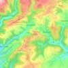
Lauperath topographic map

Click on the map to display elevation.

About this map

Name: Lauperath topographic map, elevation, terrain.

Location: Lauperath, Arzfeld, Eifelkreis Bitburg-Prüm, Rijnland-Palts, Duitsland (50.07472 6.29985 50.09670 6.36098)

Average elevation: 1,486 ft

Minimum elevation: 1,060 ft

Maximum elevation: 1,824 ft

Other topographic maps

Click on a map to view its topography, its elevation and its terrain.

Buscht

Duitsland > Rijnland-Palts > Eifelkreis Bitburg-Prüm

Average elevation: 1,234 ft

Gear up for your next adventure:

🧴Hand Sanitizer - Keep hands clean while hiking
🗺️Topographic Maps - Detailed topo maps for hiking, exploring and outdoor navigation
🦶Carbon Trekking Poles - Reduce knee impact on steep descents with ultra-light poles
🧦Hiking Socks - Comfortable socks to prevent blisters on long hikes
👟Men's Trail Runners - Lightweight footwear for fast-paced exploration and light hiking

As an Amazon Associate, this site earns from qualifying purchases at no extra cost to you.