Geolocate

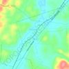
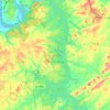
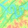
Busselltown topographic map

Click on the map to display elevation.

About this map

Name: Busselltown topographic map, elevation, terrain.

Location: Busselltown, Loudon County, East Tennessee, Tennessee, 37772, United States (35.75536 -84.25436 35.79536 -84.21436)

Average elevation: 853 ft

Minimum elevation: 748 ft

Maximum elevation: 1,112 ft

Loudon County trails, hiking, mountain biking, running and outdoor activities

Other topographic maps

Click on a map to view its topography, its elevation and its terrain.
Loudon

United States > Tennessee > Loudon County

Average elevation: 876 ft

Philadelphia

United States > Tennessee > Loudon County

Average elevation: 915 ft

Lenoir City

United States > Tennessee > Loudon County

Average elevation: 922 ft

Tellico Dam

United States > Tennessee > Loudon County

Average elevation: 797 ft

Greenback

United States > Tennessee > Loudon County

Average elevation: 912 ft

Tellico Village

United States > Tennessee > Loudon County

Average elevation: 912 ft

Greenback

United States > Tennessee > Loudon County

Average elevation: 912 ft

Lenoir City

United States > Tennessee > Loudon County

Average elevation: 922 ft

Tellico Village

United States > Tennessee > Loudon County

Average elevation: 912 ft

Tellico Village

United States > Tennessee > Loudon County

Average elevation: 912 ft

Gear up for your next adventure:

🧷Carabiner Set - Durable clips for gear attachment
🕶️GPS Smartphone Mount - Secure mount for phone navigation
🛠️Backpacking Tool Kit - Essential toolkit for outdoor repairs
🪶Wildlife Field Guides - Learn animal tracking and species ID
🌎3D Topographic Globes - Raised relief globes for a tactile understanding of geography

As an Amazon Associate, this site earns from qualifying purchases at no extra cost to you.