Geolocate

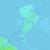
Chirignago topographic map

Click on the map to display elevation.

About this map

Name: Chirignago topographic map, elevation, terrain.

Location: Chirignago, Venezia, Veneto, 30038, Italia (45.46471 12.16881 45.50471 12.20881)

Average elevation: 13 ft

Minimum elevation: 0 ft

Maximum elevation: 33 ft

Other topographic maps

Click on a map to view its topography, its elevation and its terrain.

Lido di Venezia

Italia > Veneto > Venezia > Venezia > Lido

Average elevation: 3 ft

Campalto

Italia > Veneto > Venezia > Venezia

Average elevation: 0 ft

San Pietro

Italia > Veneto > Venezia > Venezia > Murano

Average elevation: 3 ft

Spiaggia di Caroman

Italia > Veneto > Venezia > Venezia

Average elevation: 0 ft

Murano

Italia > Veneto > Venezia > Venezia > Murano

Average elevation: 0 ft

Isola Torcello

Italia > Veneto > Venezia > Venezia > Burano

Average elevation: 0 ft

Isola di Pellestrina

Italia > Veneto > Venezia > Venezia > Pellestrina

Average elevation: 0 ft

Isola Le Vignole

Italia > Veneto > Venezia > Venezia > Sant'Erasmo

Average elevation: 0 ft

Poveglia

Italia > Veneto > Venezia > Venezia > Malamocco

Average elevation: 0 ft

Murano

Italia > Veneto > Venezia > Venezia > Murano

Average elevation: 0 ft

Gear up for your next adventure:

🪶Wildlife Field Guides - Learn animal tracking and species ID
🗺️NatGeo Topo Maps - High-quality waterproof printed topographic maps of US Parks
❄️Traction Cleats - Prevent slips on icy trails during winter hikes
🧼Biodegradable Camping Soap - Eco‑friendly soap for outdoor hygiene
🪶Thermal Camp Blanket - Extra warmth for cold nights

As an Amazon Associate, this site earns from qualifying purchases at no extra cost to you.