Geolocate

Barra topographic map

Click on the map to display elevation.

About this map

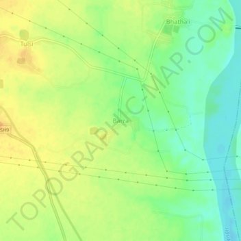
Name: Barra topographic map, elevation, terrain.

Location: Barra, Nawagarh Tahsil, Janjgir-Champa, Chhattisgarh, India (21.76145 82.68760 21.80145 82.72760)

Average elevation: 755 ft

Minimum elevation: 696 ft

Maximum elevation: 804 ft

Other topographic maps

Click on a map to view its topography, its elevation and its terrain.

Kanji

India > Chhattisgarh > Nawagarh Tahsil > Kamta

Average elevation: 791 ft

Gear up for your next adventure:

🛠️Backpacking Tool Kit - Essential toolkit for outdoor repairs
Backpacking Tent - Lightweight and durable tent for multi‑day hikes
🌡️Handheld Weather Meters - Measure wind, temp, and pressure for safe mountain travel
📻Weather Alert Radios - Stay informed of storm risks while off-the-grid
📶Vehicle Signal Boosters - Improve reception in rural areas while driving to trailheads

As an Amazon Associate, this site earns from qualifying purchases at no extra cost to you.