
Thank you for supporting this site ❤️
Make a donation
Make a donation
Gear up for your next adventure:
As an Amazon Associate, this site earns from qualifying purchases at no extra cost to you.
Tabuaço topographic map
Click on the map to display elevation.
Thank you for supporting this site ❤️
Make a donation
Make a donation
Gear up for your next adventure:
As an Amazon Associate, this site earns from qualifying purchases at no extra cost to you.
About this map
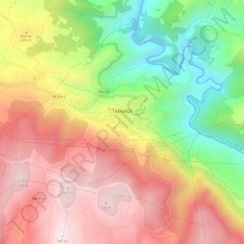
Name: Tabuaço topographic map, elevation, terrain.
Location: Tabuaço, Viseu, Douro, Norte, Portugal (41.09580 -7.60179 41.13454 -7.54166)
Average elevation: 1,811 ft
Minimum elevation: 276 ft
Maximum elevation: 3,150 ft
Thank you for supporting this site ❤️
Make a donation
Make a donation
Gear up for your next adventure:
As an Amazon Associate, this site earns from qualifying purchases at no extra cost to you.