
Thank you for supporting this site ❤️
Make a donation
Make a donation
Gear up for your next adventure:
As an Amazon Associate, this site earns from qualifying purchases at no extra cost to you.
Mogotes topographic map
Click on the map to display elevation.
Thank you for supporting this site ❤️
Make a donation
Make a donation
Gear up for your next adventure:
As an Amazon Associate, this site earns from qualifying purchases at no extra cost to you.
About this map
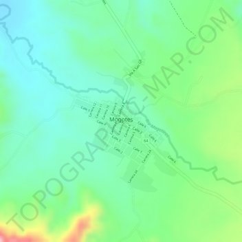
Name: Mogotes topographic map, elevation, terrain.
Location: Mogotes, Guanentá, Santander, Colombia (6.46885 -72.97638 6.48467 -72.96418)
Average elevation: 5,545 ft
Minimum elevation: 5,348 ft
Maximum elevation: 5,971 ft
Thank you for supporting this site ❤️
Make a donation
Make a donation
Gear up for your next adventure:
As an Amazon Associate, this site earns from qualifying purchases at no extra cost to you.