
Make a donation
Gear up for your next adventure:
As an Amazon Associate, this site earns from qualifying purchases at no extra cost to you.
Walzin topographic map
Click on the map to display elevation.
Make a donation
Gear up for your next adventure:
As an Amazon Associate, this site earns from qualifying purchases at no extra cost to you.
About this map
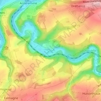
Name: Walzin topographic map, elevation, terrain.
Location: Walzin, Dinant, Namen, Wallonië, 5500, België (50.19915 4.90156 50.23915 4.94156)
Average elevation: 623 ft
Minimum elevation: 295 ft
Maximum elevation: 958 ft
Make a donation
Gear up for your next adventure:
As an Amazon Associate, this site earns from qualifying purchases at no extra cost to you.
Other topographic maps
Click on a map to view its topography, its elevation and its terrain.
Falmignoul
België > Namen > Dinant > Dinant
Falmignoul ligt aan de Falmagne. Een bijzonderheid is het Ravijn van Colèbi, een kloof waarin zich gletsjerketels (marmite de géant) bevinden, dat zijn cilindrische holtes die door turbulente stroming en de zich daarin bevindende keien werden uitgesleten. De hoogte aan de kerk bedraagt 200 meter.
Average elevation: 728 ft
Make a donation
Gear up for your next adventure:
As an Amazon Associate, this site earns from qualifying purchases at no extra cost to you.