Geolocate

Jainagar topographic map

Click on the map to display elevation.

About this map
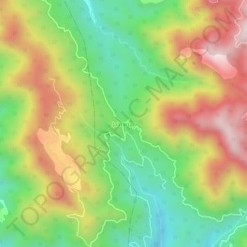
Name: Jainagar topographic map, elevation, terrain.

Location: Jainagar, Arki, Solan, Himachal Pradesh, India (31.15477 76.82986 31.19477 76.86986)

Average elevation: 3,953 ft

Minimum elevation: 2,799 ft

Maximum elevation: 5,358 ft

Gear up for your next adventure:

💧Water Purification System - Clean water on the trail with reliable purifiers
🥩Freeze-Dried Meals - Nutritious and lightweight food for remote expeditions
🪄Magnetic Compass - Accurate compass for navigation
🧭Orienteering Set - Complete compass and map reading kit
👟Men's Trail Runners - Lightweight footwear for fast-paced exploration and light hiking

As an Amazon Associate, this site earns from qualifying purchases at no extra cost to you.