
Thank you for supporting this site ❤️
Make a donation
Make a donation
Gear up for your next adventure:
As an Amazon Associate, this site earns from qualifying purchases at no extra cost to you.
Patgaon topographic map
Click on the map to display elevation.
Thank you for supporting this site ❤️
Make a donation
Make a donation
Gear up for your next adventure:
As an Amazon Associate, this site earns from qualifying purchases at no extra cost to you.
About this map
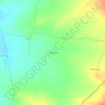
Name: Patgaon topographic map, elevation, terrain.
Location: Patgaon, Miraj, Sangli, Maharashtra, 416422, India (16.92752 74.67830 16.96752 74.71830)
Average elevation: 2,034 ft
Minimum elevation: 1,959 ft
Maximum elevation: 2,152 ft
Thank you for supporting this site ❤️
Make a donation
Make a donation
Gear up for your next adventure:
As an Amazon Associate, this site earns from qualifying purchases at no extra cost to you.