
Santa Margherita di Belice topographic map
Interactive map
Click on the map to display elevation.
About this map
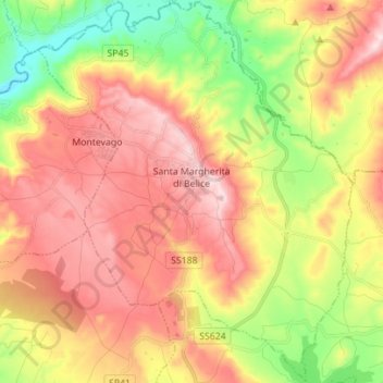
Name: Santa Margherita di Belice topographic map, elevation, terrain.
Location: Santa Margherita di Belice, Agrigent, Sizilien, 92018, Italien (37.63293 12.96461 37.74283 13.07931)
Average elevation: 902 ft
Minimum elevation: 230 ft
Maximum elevation: 1,532 ft
Other topographic maps
Click on a map to view its topography, its elevation and its terrain.