Pic du Lac Blanc topographic map
Interactive map
Click on the map to display elevation.
About this map
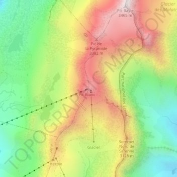
Name: Pic du Lac Blanc topographic map, elevation, terrain.
Average elevation: 9,554 ft
Minimum elevation: 8,048 ft
Maximum elevation: 11,302 ft

Click on the map to display elevation.
Name: Pic du Lac Blanc topographic map, elevation, terrain.
Average elevation: 9,554 ft
Minimum elevation: 8,048 ft
Maximum elevation: 11,302 ft